GROUND HERE: COLLABORATIVE WORKS OF KEN MCCOWN
DESIGN AND RESEARCH: URBAN, TRANSITION AND ERGONOMIC/BEHAVIORAL
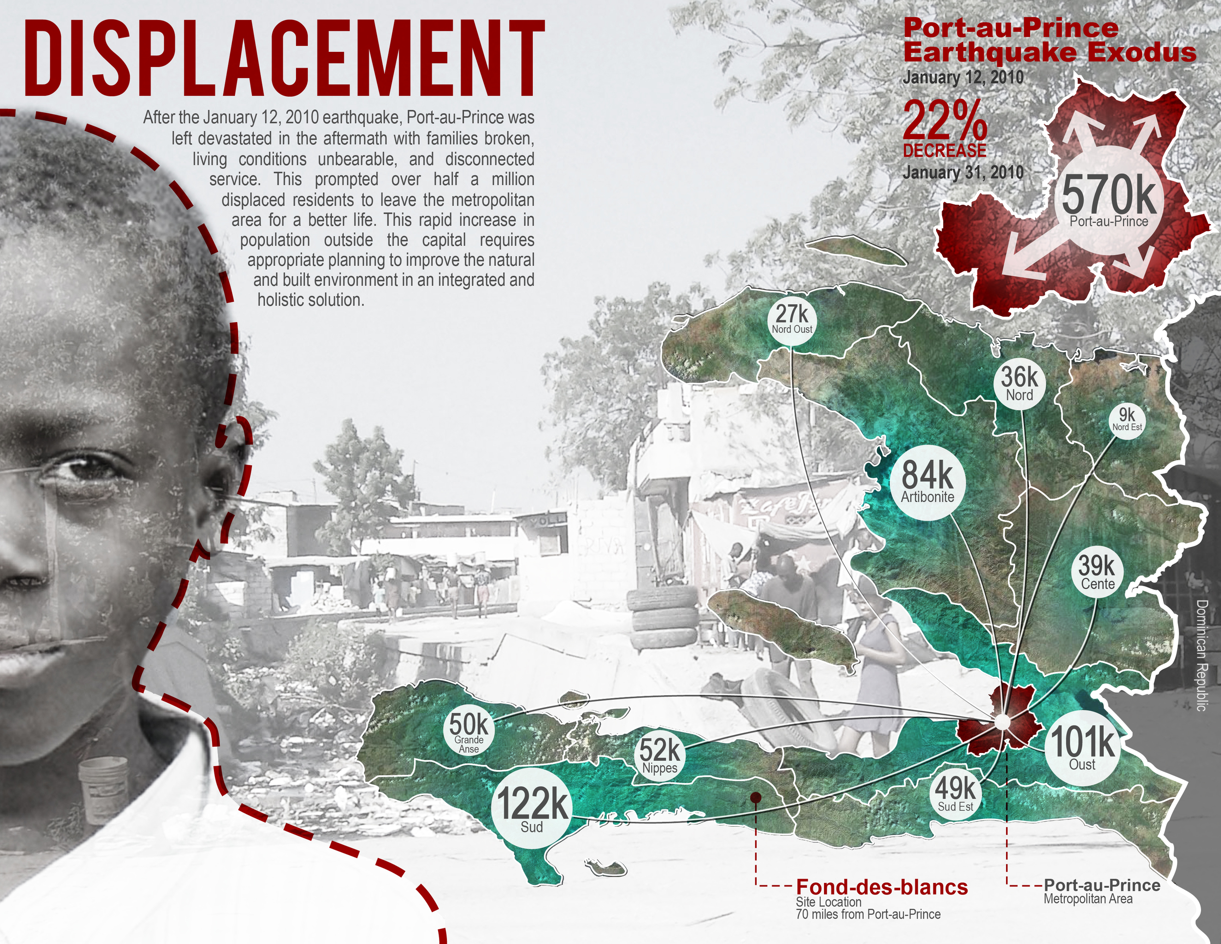
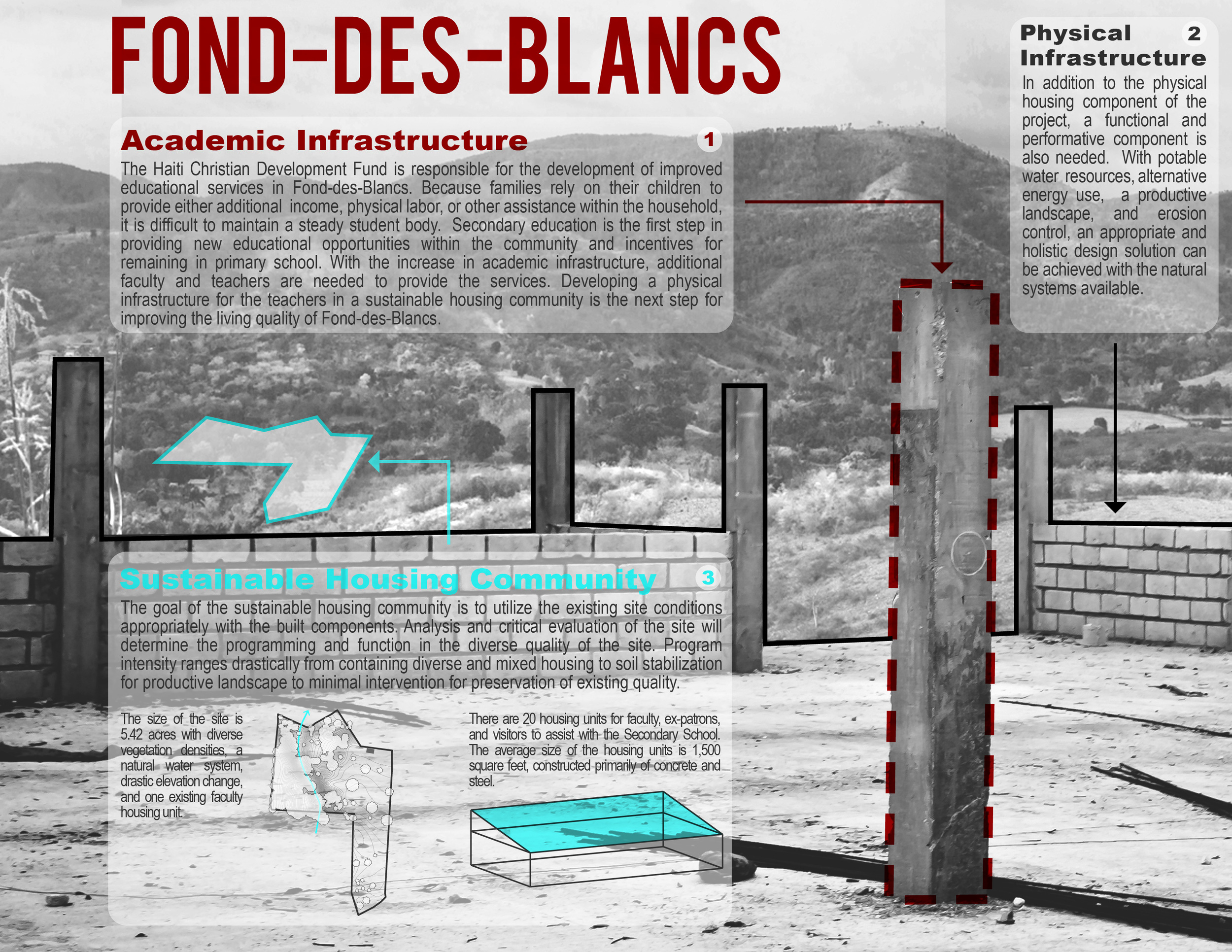
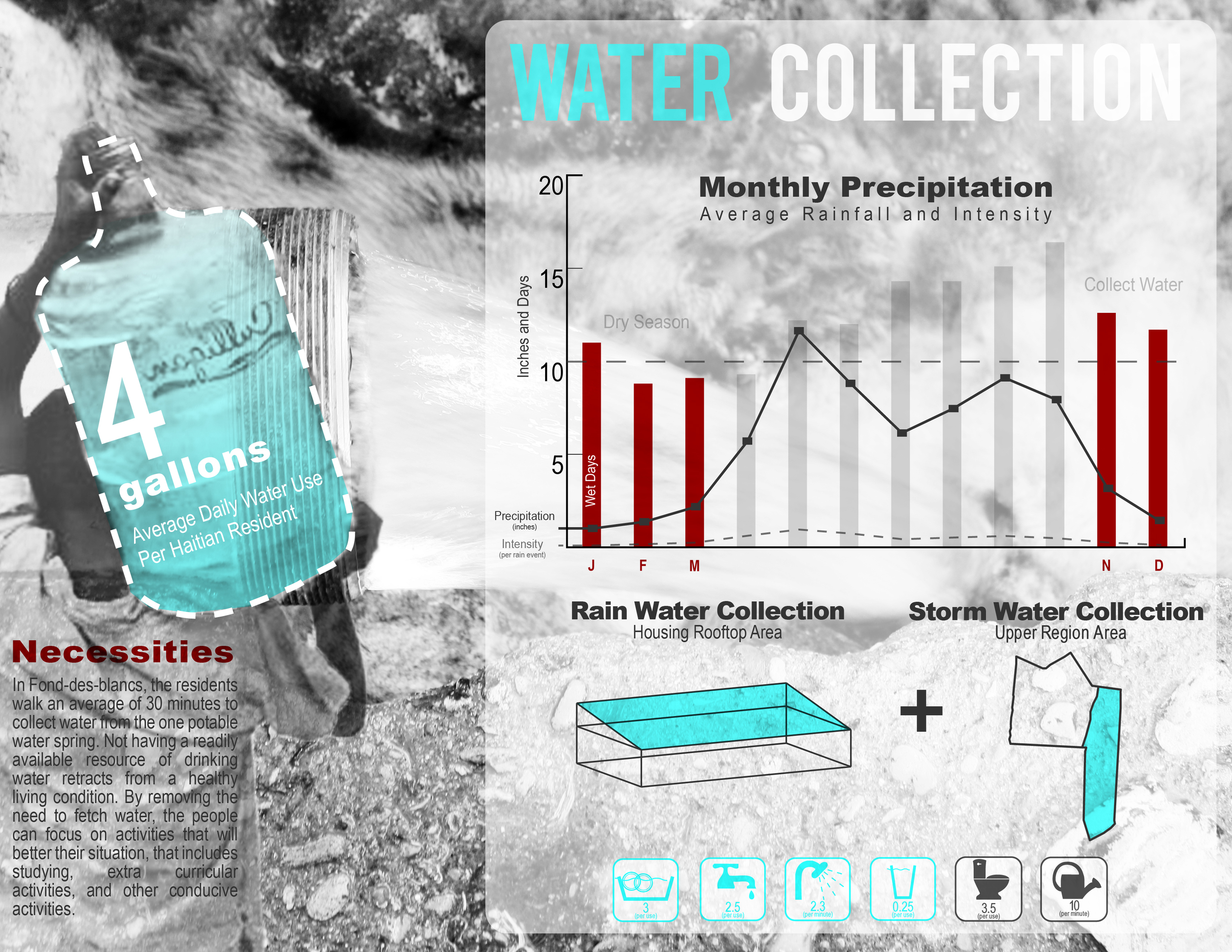
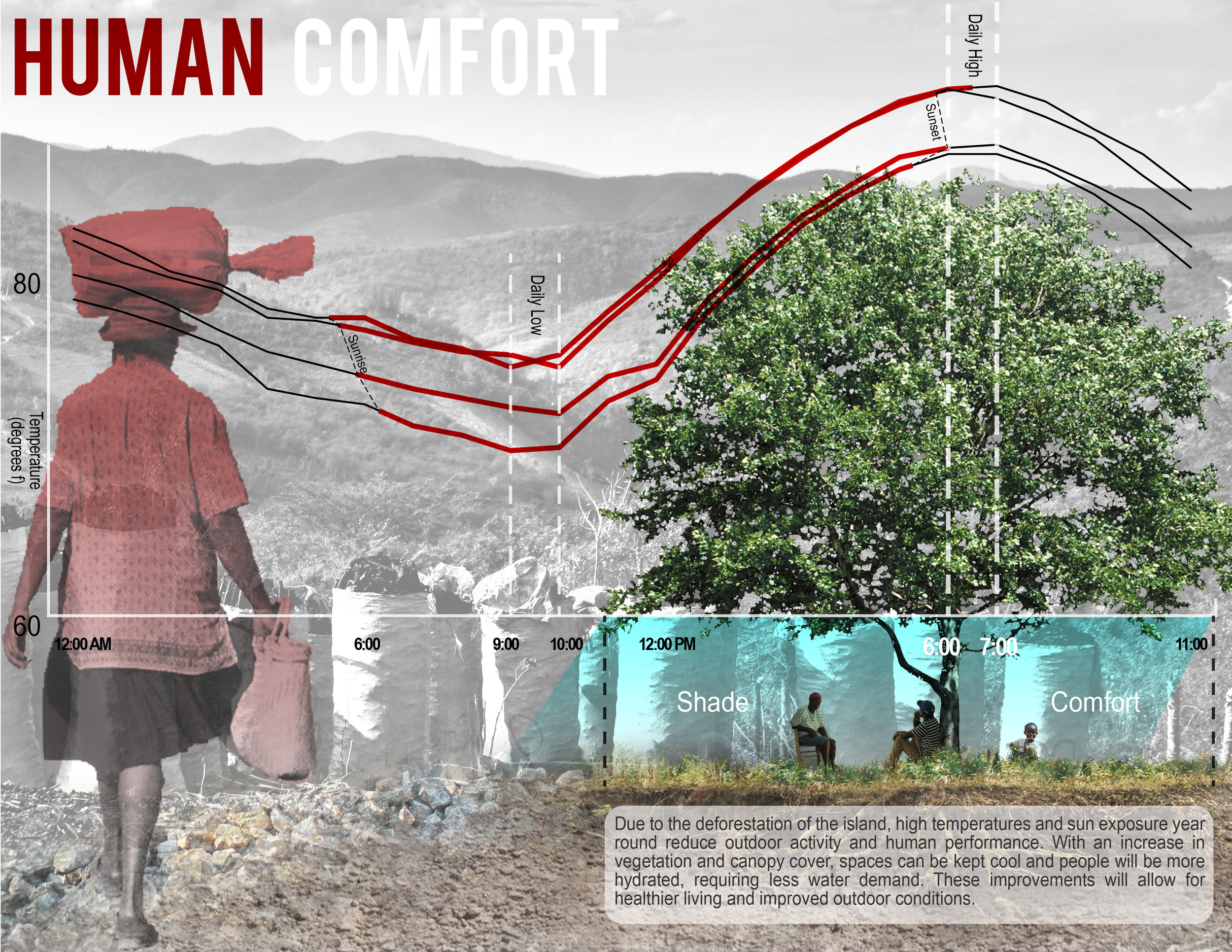
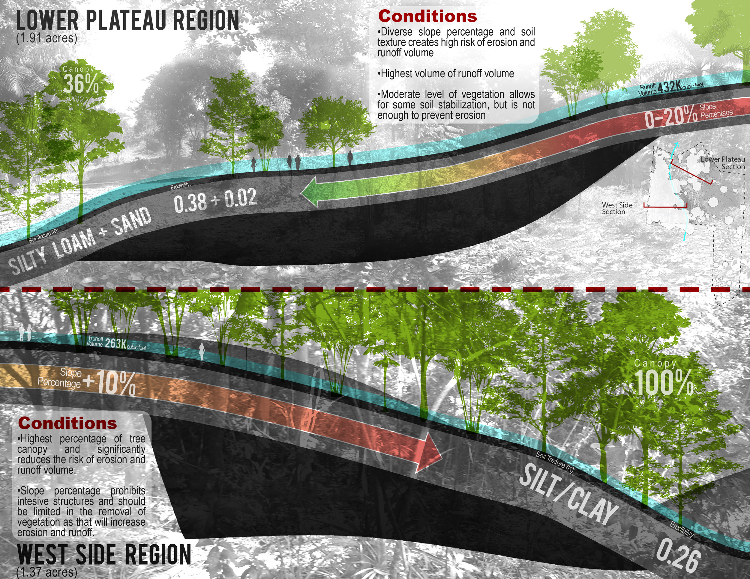
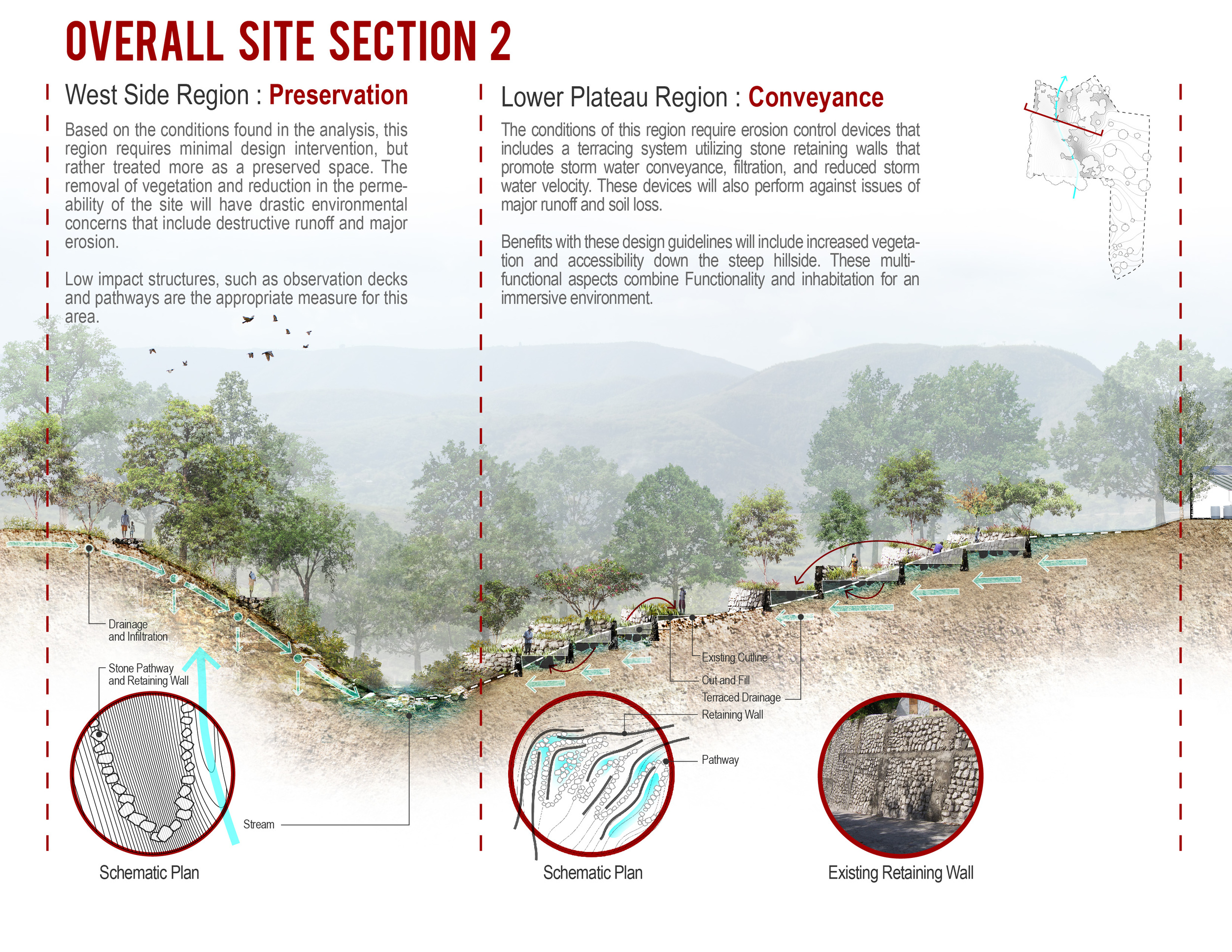
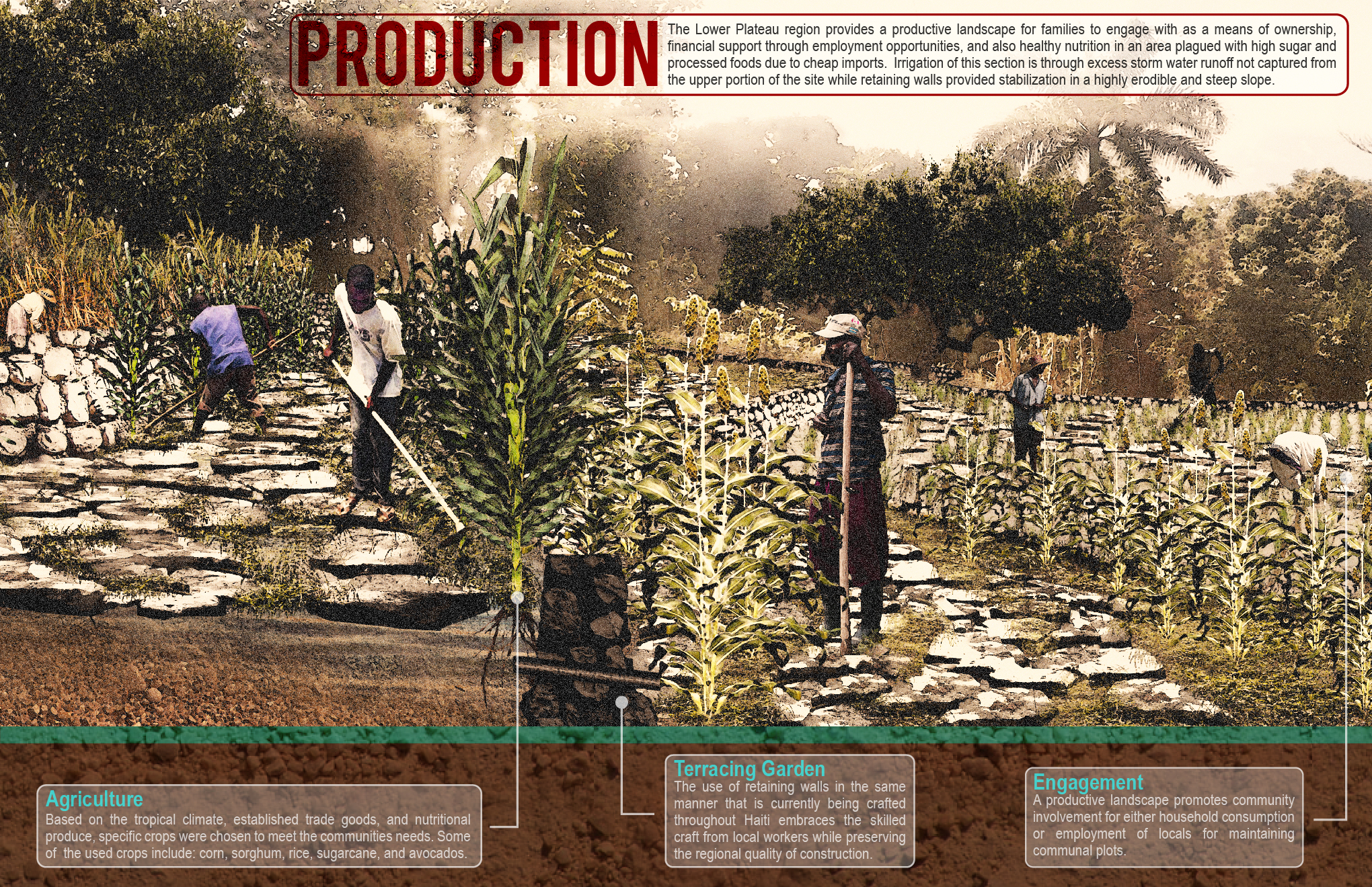
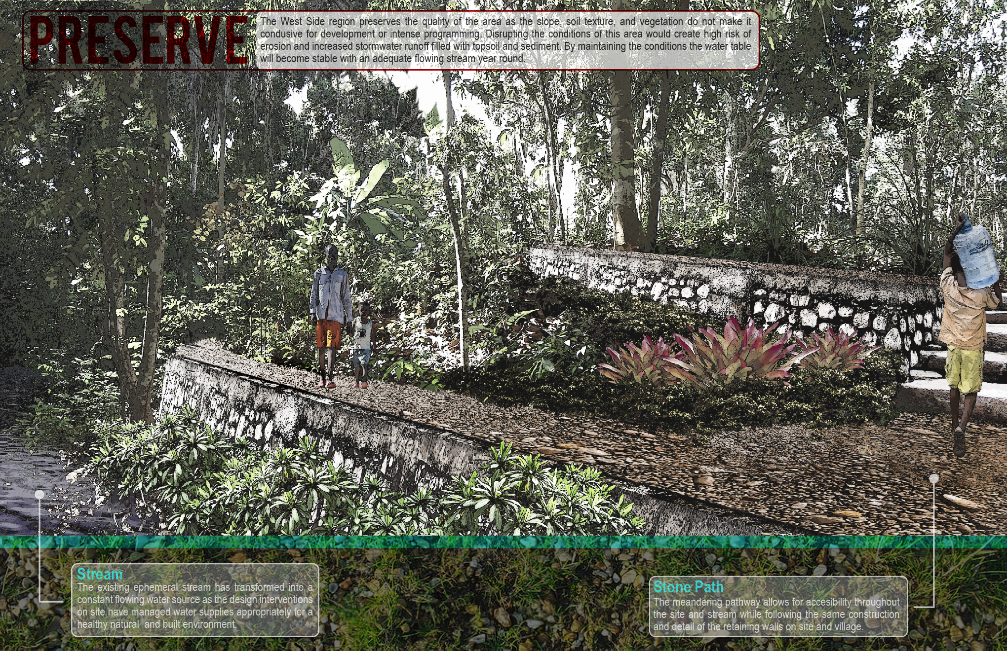
Phil Zawarus partnered with an architecture and interior design studio to work on a school housing project in rural Haiti. He was the only landscape architecture student on the project. He wanted to test digital tools to see if animations of landscape/sustainability processes could help non-landscape based professionals and laypersons see ecological processes. Would showing water, climate and solar related data dynamically change the design responses of designers, and reprioritize allocations of resources by clients?
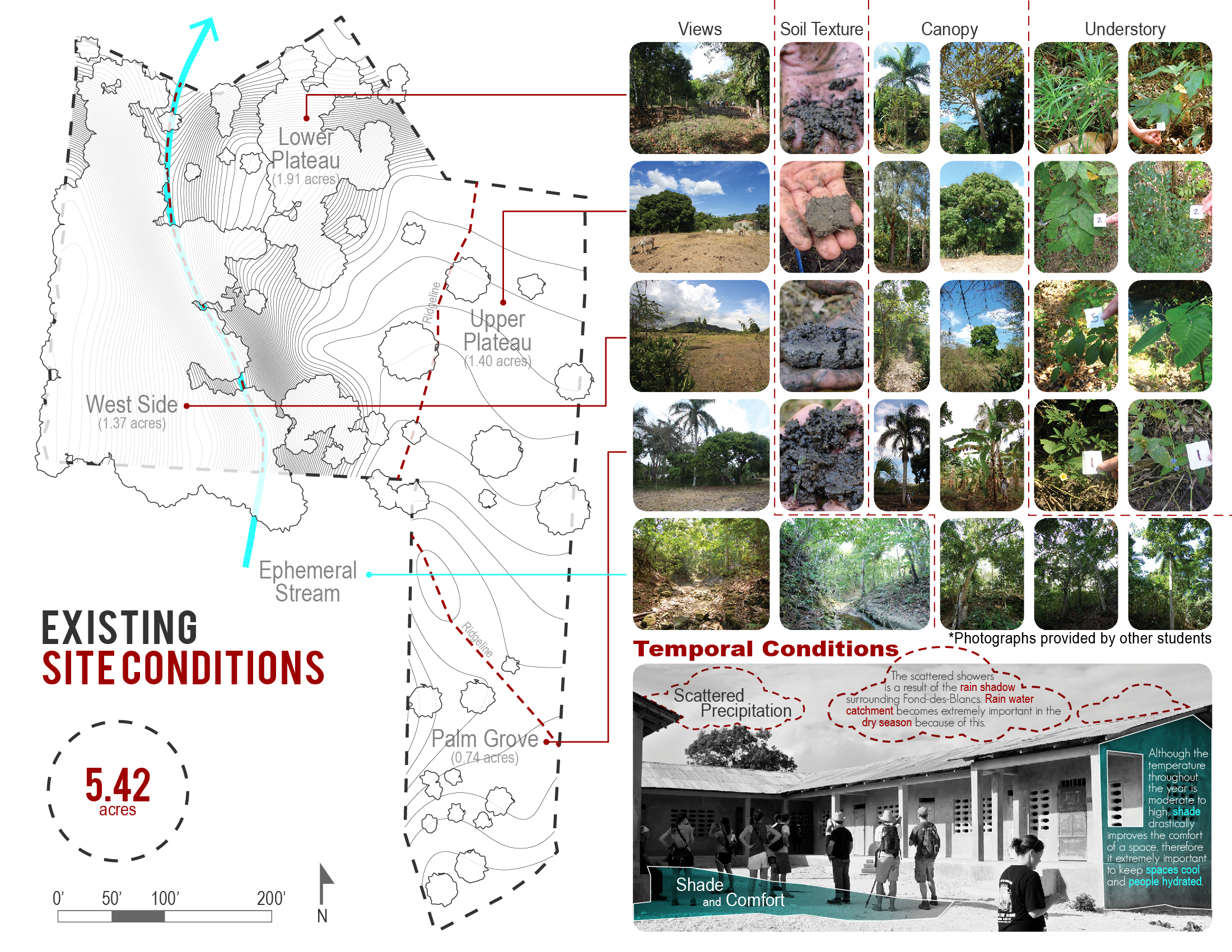
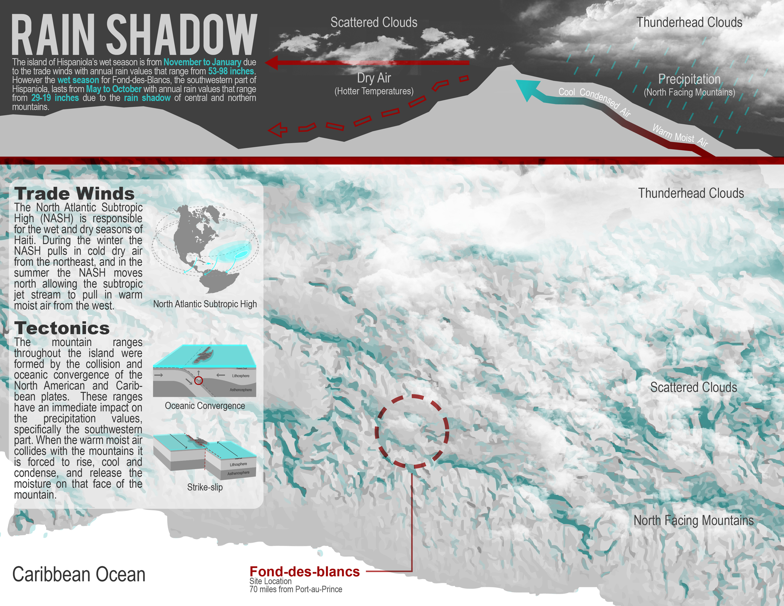
Phil prepared dynamic visualizations through the analysis phase of a design/build project in Fond-des-blancs, and also used them in site planning and design. His work changed the direction of the architects and designers on the project. Building orientation shifted due to solar gain and water harvesting, and site design changed.
The essential part of this project that drove all decisions was water. How could we harvest water, clean it, and maximize its use? People needed to be as cool as possible to minimize their need for drinking water. Occupants needed to use water multiple times, and have that water cleaned. Phil’s inventory, analysis, plan and design shows how water leads to manifold design decisions.
Ken McCown, thesis advisor, 2011. The project can be found here as a full document. (click on images above to advance slide show) Phil's dynamic visualizations can be seen here.
